ANG 6930: Remote Sensing of Cultural Landscapes#
University of Florida
Spring 2026
Instructor
Whittaker Schroder
Turlington B129
(352) 294-6396
wschroder@ufl.edu
Description
Remote sensing is the collection and analysis of spatial data through the
observation and scanning of large areas from a distance. The applications of remote
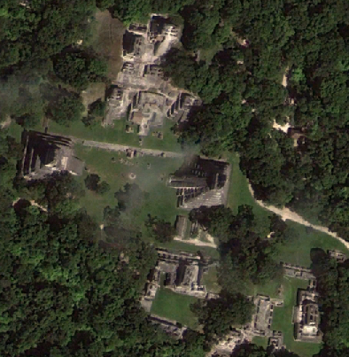
sensing in anthropology and archaeology are extensive, including site and feature prospection, mapping,
topographic analysis, hydrological analysis, 3D modeling, subsurface imaging,
vegetation, soil classification, among others. This course discusses the history and
theory of the use of remote sensing of cultural landscapes. The class will explore the use and
analysis of remote sensing datasets from aerial photography, satellite imagery,
laser scanning, radar, and thermal sensors to interpret archaeological sites, landscapes,
land cover change, land use, and other environmental applications.
In addition to assessing case studies of remote sensing applications in anthropology,
students will learn how to collect, preprocess, process, visualize, and analyze data.
The course will also address ethical considerations in conducting remote sensing research.
Course Objectives
By the end of the course, students will:
be able to explain the principles, fundamentals, and applications of remote sensing for spatial analysis in anthropology and other disciplines.
know how to access and analyze satellite and other remote sensing data for anthropological and environmental applications.
become familiar with processing remote sensing data across several platforms, including ArcGIS Pro, QGIS, Agisoft Metashape, LAStools, Google Earth Engine, R, and Python.
be able to evaluate and develop workflows for specific remote sensing analyses, from data collection to preprocessing, classification, and accuracy assessment.
consider the ethical ramifications of their work and the challenges facing the use and collection of remote sensing data in the twenty-first century.
Prerequisites
This class has no prerequisites, but some previous knowledge of GIS, coding, and photography will be beneficial.
Class Meetings
Friday, Periods 4–6, 10:40 am–1:40 pm
Weimer Hall 2050
Office Hours
Tuesday, 11:30 am–1:30 pm
Thursday, 12:30-1:30 pm
Turlington B129
Recommended Books and Resources
Fundamentals of Remote Sensing. A Canada Centre for Remote Sensing Tutorial. https://www.nrcan.gc.ca/sites/www.nrcan.gc.ca/files/earthsciences/pdf/resource/tutor/fundam/pdf/fundamentals_e.pdf
ESRI. Introduction to Imagery and Remote Sensing. https://introduction-to-remote-sensing-learngis.hub.arcgis.com/
Kerle, Norman, Lucas L.F. Janssen, Gerrit C. Huurneman (editors). Principles of Remote Sensing: An Introductory Textbook. https://www.researchgate.net/publication/233793398_Principles_of_remote_sensing_an_introductory_textbook
These textbooks are available for free online.
Additional Required Readings
Additional readings and case studies will be provided each week.
Grading
A 93-100% |
B+ 87-89.9 |
C+ 77-79.9 |
D+ 67-69.9 |
E<60 |
A- 90-92.9 |
B 83-86.9 |
C 73-76.9 |
D 63-66.9 |
|
B- 80-82.9 |
C- 70-72.9 |
D- 60-62.9 |
https://catalog.ufl.edu/UGRD/academic-regulations/grades-grading-policies
Attendance and Participation |
15% |
Weekly Labs |
32% |
Seminar Facilitation |
15% |
Project Site Selection |
3% |
Presentation |
5% |
Final Project |
30% |
Attendance and Participation
Attendance is crucial to get the most out of this course.
If you must miss a class meeting, please let me know by email
or in person as soon as possible. I encourage you to discuss
what you missed with another student or attend my office hours.
Participation includes engagement during lectures and contributions to discussions.
Requirements for class attendance and make-up exams, assignments,
and other work in this course are consistent with university policies
(https://catalog.ufl.edu/UGRD/academic-regulations/attendance-policies).
Readings
Readings will be posted on the course website and should be completed before the
relevant class period. A goal of this course is to create a resource that students can use to learn
about remote sensing, so feel free to contribute additional readings in the context of that week’s topic.
Seminar Facilitation
Each week, students will be divided into teams to guide the discussion of that week’s readings, taking up somewhere between 30 and 60 minutes of class time. Each student will likely be responsible for two seminar discussions, depending on course enrollment.
Labs
Every class period will have a lab component to introduce topics and techniques.
We will use example data in class, and students will be required to conduct the same analyses
on their own data relevant to their final project. Lab work will continue outside of class and will be presented the following week. The results of these labs will be posted on the
Canvas discussion board prior to the next class meeting.
Final Project
Students will develop a project throughout the semester. After the first class meeting
students will select a research site/area, ideally related to their dissertation or
thesis project, to be posted as a Google Earth .kml file to the class blog. The next
phase of the project will be the crafting of a research question. The final project will
be a proposal and preliminary analysis of your research area, using methods and tools
learned in class. If the data needed to address your research question are not available,
discuss how you would realistically plan to acquire such data. Students will present
project updates prior to final submission during the last two weeks of class.
Academic Honesty and Integrity
Please be familiar with the University of Florida’s Student Honor Code:
https://sccr.dso.ufl.edu/policies/student-honor-code-student-conduct-code
Special Accommodations
The process for requesting special accommodations is described at
https://disability.ufl.edu/get-started, including registering with the
Disability Resource Center in Reid Hall and requesting an accommodation
letter to be presented to the instructor.
Online Course Evaluation
Students are expected to provide professional and respectful feedback on
the quality of instruction in this course by completing course evaluations
online via GatorEvals. Guidance on how to give feedback in a professional
and respectful manner is available at https://gatorevals.aa.ufl.edu/students.
Students will be notified when the evaluation period opens and can complete
evaluations through the email they receive from GatorEvals, in their Canvas
course menu under GatorEvals, or via https://ufl.bluera.com/ufl. Summaries of
course evaluation results are available to students at
https://gatorevals.aa.ufl.edu/public-results.
Course Schedule#
Week 1 |
Course Introduction |
Week 2 |
Project Site Selection Due (posted as a Google Earth .kml file on the Canvas discussion board |
Week 3 |
Lab 2 Due |
Week 4 |
Lab 3 Due |
Week 5 |
Lab 4 Due |
Week 6 |
Lab 5 Due |
Week 7 |
Lab 6 Due |
Week 8 |
Lab 7 Due |
Week 9 |
Lab 8 Due |
Week 10 |
Spring Break |
Week 11 |
Subsurface Remote Sensing and Geophysics |
Week 12 |
Lab 9 Due |
Week 13 |
Ethics in Remote Sensing |
Week 14 |
Student Presentations |
Week 15 |
Final Projects Due |
Table of Contents#
- Install Required Software
- 1. Aerial Photography and Stereoscopic Imaging
- 2. Orthorectifying CORONA Satellite Imagery
- 3. Digital Surface Models and Orthoimagery in Agisoft Metashape
- 4. Drone Mission Planning for Photogrammetry
- 5. Topographic Analysis with ASTER and SRTM Digital Elevation Models
- 6. Multispectral Imagery
- 7. Leveraging Remotely-Sensed Big Data in Google Earth Engine
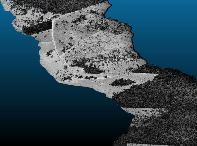
- 8. Visualizing and Processing Lidar Point Clouds in R with the lidR Package
- 9. Ground Penetrating Radar
- Ethics in Remote Sensing