Bonus: Lidar Processing and Analysis with LAStools#
LAStools is a convenient and powerful set of tools for processing point cloud data in .las or .laz format. LAStools is a subscription-based software, but some of the more basic tools are free and open source, while others are free to use with restrictions (data are slightly altered and rasters are generated with diagnonal lines, for example).
LAStools has a plugin for QGIS and a toolbox for ArcGIS Pro if you prefer to work with a GUI. LAStools also has standalone .exe files that can be run in their own GUI. However, I prefer running the tools directly in the Command Prompt to have full access to all options.
To begin, download LAStools from http://rapidlasso.de/customer-support. Unzip the folder directly into your C:\ drive, so that you have the folder structure C:\LAStools\bin.
Download data#
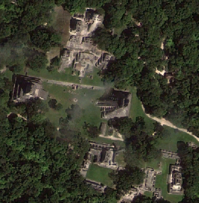
For this lab, we will use data acquired by the University of Florida’s GatorEye UAV lidar system, available at the following link under “2019 Mexico June.” Once downloaded, copy all of the .las files to a new folder C:\LAStools\bin\LTZ.
Pre-process data#
The raw data are organized by individual flight line. To work with the data, we have to first pre-process the .las files by merging them together then thinning the point cloud.
In the Command Prompt, first navigate to your working folder, which can be your C:\LAStools\bin folder, for example. If you want to have a different working folder, you must add the LAStools to PATH.
cd C:\LAStools\bin
The following command will merge all files. Refer to the lasmerge README file.
-i |
input file |
* |
wild, input all files with the same extension |
-o |
output file |
-merged |
merge .las files |
-epsg |
define the coordinate system |
-vertical_wgs84 |
sets vertical datum |
-cpu64 |
performs larger calculations per second |
las2las -i C:\LAStools\bin\LTZ\*.las -merged -epsg 32615 -o C:\LAStools\bin\LTZ\ltzmerged.las -cpu 64
The next step thins the point cloud based on a step size of 0.1, which is equivalent to a maximum point density of \(1 \over 0.1^2\) or 100 points per meter.
-step 0.1 |
point spacing |
-random |
thinning selects random points |
-lowest |
thinning selects lowest points |
-highest |
thinning selects highest points |
-last_only |
selects only last returns |
lasthin -i C:\LAStools\bin\LTZ\ltzmerged.las -step 0.1 -random -cpu64 -o C:\LAStools\bin\LTZ\ltzthinned.las
In this example, we selected points for the thinned point cloud randomly. We could also have used -lowest to select the points with the lowest elevations or Z values. These point clouds have significant low noise, however, so keeping lowest points could be detrimental to final results. We could also have just selected last returns, but we are assuming we want to keep vegetation data as well for this exercise.
Finally, we can now run the lasoptimize tool to improve processing. This tool removes unnecessary data and reorders the points in the .las file for spatial coherency.
-do_not_zero_user_data |
user data can sometimes have important information |
lasoptimize -i C:\LAStools\bin\LTZ\ltzthinned.las -do_not_zero_user_data -cpu64 -o C:\LAStools\bin\LTZ\ltzoptimized.las
To assist processing, we can also create an index (.lax) file in the same folder as our .las file.
lasindex -i C:\LAStools\bin\LTZ\ltzoptimized.las
Ground Classification#
Similar to the exercise in lidR, we have to retile the data before applying the ground classification algorithm.
The next command will retile the thinned .las into tile sizes measured in the units of the point cloud, meters.
-tile_size 250 |
width of tile in units of the data (meters) |
-buffer 25 |
buffer size |
-reversible |
allows the tiles to be combined later and remove the buffers |
-odir |
output directory |
-olas |
output file type (.las) |
lastile -i C:\LAStools\bin\LTZ\ltzthinned.las -tile_size 250 -buffer 25 -reversible -odir C:\LAStools\bin\LTZ\tiles -olas -cpu64
-nature |
default settings for “nature,” step = 5 |
-wilderness |
default settings for “wilderness,” step = 3 |
-archeology |
default settings for “archeology,” step = 1 |
-fine |
6 substeps, default |
-extra_fine |
7 substeps |
-hyper_fine |
9 substeps for very steep terrain |
-cores 4 |
process multiple inputs on number of cores in parallel |
lasground_new -i C:\LAStools\bin\LTZ\Ground\Tiles\*.las -wilderness -odir C:\LAStools\bin\LTZ\Ground\Tiles\Ground -olas -cpu64 -cores 4
lastile -i C:\LAStools\bin\LTZ\Ground\Tiles\Ground\*.las -reverse_tiling -o C:\LAStools\bin\LTZ\Ground\ltzground.las
blast2dem -i C:\LAStools\bin\LTZ\Ground\ltzground.las -keep_class 2 -o C:\LAStools\bin\LTZ\Ground\ltzwild.tif
References#
Kashani, Alireza G., Michael J. Olsen, Christopher E. Parrish, and Nicholas Wilson. 2015. A Review of LIDAR Radiometric Processing: From Ad Hoc Intensity Correction to Rigorous Radiometric Calibration. Sensors 15:28099–28128. https://doi.org/10.3390/s151128099
Scaioni, M., B. Höfle, A.P. Baungarten Kersting, L. Barazzetti, M. Previtali, and D. Wujanz. 2018. Methods from Information Extraction from LiDAR Intensity Data and Multispectral LiDAR Technology. The International Archives of the Photogrammetry, Remote Sensing and Spatial Information Sciences 52(3):1503–1510. https://www.int-arch-photogramm-remote-sens-spatial-inf-sci.net/XLII-3/1503/2018/isprs-archives-XLII-3-1503-2018.pdf