Bonus: Machine Learning Approaches in Remote Sensing#
This lab uses a modified approach to image classification using neural networks in the TensorFlow Python library.
Install Python Libraries#
We will use Google Colab to run the Python code for this exercise. Doing so does not require any local installations on your computer, but you will need a Google account. Alternatively, you can download Python and run the code in Jupyter Notebook, for example. If you are running the code locally and need to locate Python, you can use the following code:
import sys

locate_python = sys.exec_prefix

print(locate_python)
To install the Python libraries locally, in the Command Prompt navigate to the Scripts folder in the Python location folder and run the following lines to install the necessary libraries.
pip install pyrsgis
pip install scikit-learn
pip install "numpy<2.0"
pip install Tensorflow
Alternatively, in Google Colab, run the same code with an exclamation point (!) before the commands. This symbol serves as an escape symbol to tell Google Colab the code is a command and not Python.
!pip install pyrsgis
The other libraries should already be installed in Google Colab, but if not, run the same commands above with the exclamation point in front.
Once installed, import the following (either in Jupyter Notebook or Google Colab, now no exclamation point is needed because from now on we are working strictly in Python):
from pyrsgis import raster
In Google Colab, run the following command to “print working directory:”
!pwd
In Jupyter Notebook, run the following code to locate your working directory:
import os
os.getcwd()
And to change your working directory:
os.chdir("folderpath")
The result should be /content.
Prepare Data#
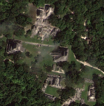
For this exercise, we need training data and test data, all in raster format. The training data will be 1) a multiband raster surface representing elevation and elevation derivatives and 2) an annotated surface representing archaeological features. The test data will be a separate multiband raster surface representing elevation and elevation derivatives that has not yet been annotated. We will build a model to identify archaeological features given similar input topographical data.
We will use lidar data from NASA G-LiHT’s 2013 flights over southeastern Mexico. Download the AMIGACarb_Yuc_North_2_GLAS_Apr2013_l3s454.las and AMIGACarb_Yuc_North_2_GLAS_Apr2023_l3s455.las files.
All data must be in the same format with the same bit depth. The training data (multiband raster and annotated surface) must have the exact same coordinate system, spatial extent, and dimensions.
In QGIS, load the DEM raster and the annotated features. Use the Rasterize (vector to raster) tool to convert the features to a raster. Change the fixed value of burn to 1, output raster size units to Georeferenced units, and the width and height resolution to match the DEM raster. Under Output extent, select Calculate from Layer, and select the DEM raster.
In ArcGIS Pro, run the Polygon to Raster tool to convert the features to raster. Under Environments, select the DEM raster under Extent (Extent of a Layer) and Snap Raster. The tool assigns each structure a unique value, so run the Slice tool with number of output zones set to 1, and starting value for output set to 1.
Define Variables and Reshape Data#
Before training the model, we need to upload the training and test data, and reformat them for the machine learning algorithm. If working in Google Colab, mount your Google Drive:
from google.colab import drive
drive.mount('/content/drive')
In the lefthand Files window, you should be able to navigate to your Drive files under content/drive/MyDrive.
Now we can define our variables in Google Colab or Jupyter Notebook, where inputcomp is our input training multiband raster composite surface, inputannot is a raster surface of our annotations, and testcomp is our testing multiband raster composite surface for after we train the model:
inputcomp = '/content/drive/MyDrive/MLfiles/s416composite.tif'
inputannot = '/content/drive/MyDrive/MLfiles/s416strs.tif'
testcomp = '/content/drive/MyDrive/MLfiles/s415composite.tif'
Now we reshape the data into an array (essentially a list of values assigned to a category) and print the results:
ds1, featuresinput = raster.read(inputcomp, bands = 'all')
ds2, labelinput = raster.read(inputannot, bands = 1)
ds3, featurestest = raster.read(testcomp, bands = 'all')

print("Composite Input: ", featuresinput.shape)
print("Annotated Input: ", labelinput.shape)
print("Test Data: ", featurestest.shape)
Finally, we reshape the data into a two-dimensional array (essentially making each pixel it’s own row in a table):
from pyrsgis.convert import changeDimension

featuresinput = changeDimension(featuresinput)
labelinput = changeDimension(labelinput)
featurestest = changeDimension(featurestest)
nBands = featuresinput.shape[1]
labelinput = (labelinput == 1).astype(int)

print(nBands)
print("Composite Input: ", featuresinput.shape)
print("Annotated Input: ", labelinput.shape)
print("Test Data: ", featurestest.shape)
Training the Model#
We are now ready to train our model. First, we split the training data into training (60%) and test (40%) samples to avoid overfitting the data:
from sklearn.model_selection import train_test_split

xTrain, xTest, yTrain, yTest = train_test_split(featuresinput, labelinput, test_size = 0.4, random_state = 42)

print(xTrain.shape)
print(yTrain.shape)

print(xTest.shape)
print(yTest.shape)
Now we normalize the data to ensure all data ranges between 0 and 1. To normalize data, use the following equation:
For 8-bit data:
Which is the following in code:
xTrain = xTrain/255.0
xTest = xTest/255.0
featurestest = featurestest/255.0
And we additionally reshape one more time to a three-dimensional array:
xTrain = xTrain.reshape((xTrain.shape[0], 1, xTrain.shape[1]))
xTest = xTest.reshape((xTest.shape[0], 1, xTest.shape[1]))
featurestest = featurestest.reshape((featurestest.shape[0],1,featurestest.shape[1]))

print(xTrain.shape, xTest.shape, featurestest.shape)
Now we can define the model:
from tensorflow import keras

model = keras.Sequential([
	keras.layers.Flatten(input_shape=(1, nBands)),
	keras.layers.Dense(14, activation='relu'),
	keras.layers.Dense(2, activation='softmax')])

model.compile(optimizer="adam", loss="sparse_categorical_crossentropy", metrics=["accuracy"])
And finally, we can run the model:
model.fit(xTrain, yTrain, epochs=2)
Assessing the Results#
Once the model has been trained, we can test the accuracy of the model on the test data:
from sklearn.metrics import confusion_matrix, precision_score, recall_score

yTestPredicted = model.predict(xTest)
yTestPredicted = yTestPredicted[:,1]

yTestPredicted = (yTestPredicted>0.5).astype(int)
cMatrix = confusion_matrix(yTest, yTestPredicted)
pScore = precision_score(yTest, yTestPredicted)
rScore = recall_score(yTest, yTestPredicted)

print(cMatrix)
print("\nP-score: %.3f, R-Score: %.3f" % (pScore, rScore))
We can view the confusion matrix with the pandas library:
import pandas as pd
from sklearn.metrics import confusion_matrix, ConfusionMatrixDisplay

cm = confusion_matrix(yTest, yTestPredicted)
disp = ConfusionMatrixDisplay(confusion_matrix=cm)
disp.plot()
Predicting the Test Data#
Now we can use the trained model on brand new data for predictions:
import numpy as np

predicted = model.predict(featurestest)
predicted = predicted[:,1]
And we can convert back to raster:
prediction = np.reshape(predicted, (ds3.RasterYSize, ds3.RasterXSize))
And export for viewing:
outFile = '/content/drive/MyDrive/MLfiles/prediction.tif'
raster.export(prediction, ds3, filename=outFile, dtype='float')
References#
Bickler, Simon H. 2021. Machine Learning Arrives in Archaeology. Advances in Archaeological Practice 9(2):186-191. https://doi.org/10.1017/aap.2021.6
Casini, Luca, Nicolò Marchetti, Andrea Montanucci, Valentina Orrù, and Marco Roccetti. 2023. A Human–AI Collaboration Workflow for Archaeological Sites Detection. Scientific Reports 13:8699. https://www.nature.com/articles/s41598-023-36015-5
Character, Leila, Agustin Ortiz, Jr., Tim Beach, and Sheryl Luzzadder-Beach. 2021. Archaeologic Machine Learning for Shipwreck Detection Using Lidar and Sonar. Remote Sensing 13(9):1759. https://doi.org/10.3390/rs13091759
Davis, D.S., J. Cook Hale, N. L. Hale, T. Z. Johnston, and M. C. Sanger. 2024. Bathymetric LiDAR and Semi-Automated Feature Extraction Assist Underwater Archaeological Surveys. Archaeological Prospection 31(2):171-186. https://doi.org/10.1002/arp.1939
Gattiglia, Gabriele. 2025. Managing Artificial Intelligence in Archeology. An Overview. Journal of Cultural Heritage 71:225-233. https://doi.org/10.1016/j.culher.2024.11.020