7. Pansharpening, Spectral Indices, and Texture Analysis#
Readings#
Alders, W., Davis, D.S. & Haines, J.J. 2024. Archaeology in the Fourth Dimension: Studying Landscapes with Multitemporal PlanetScope Satellite Data. Journal of Archaeological Method and Theory 31:1588–1621. https://doi.org/10.1007/s10816-024-09644-x.
Brondizio and Chowdhury. 2010. Spatiotemporal methodologies in environmental anthropology: geographic information systems, remote sensing, landscape changes, and local knowledge. In: Vaccaro I, Smith EA, Aswani S, eds. Environmental Social Sciences: Methods and Research Design. Cambridge University Press, pp. 266-298.
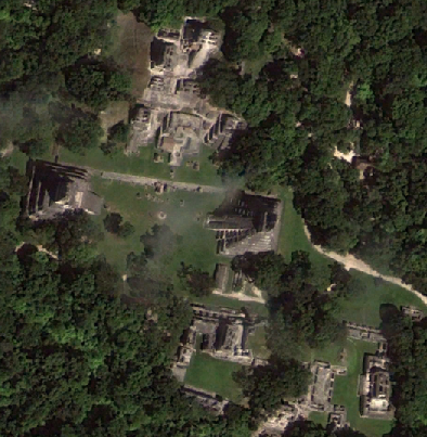
Garrison, Thomas G., Stephen D. Houston, Charles Golden, Takeshi Inomata, Zachary Nelson, and Jessica Munson. 2008. Evaluating the Use of IKONOS Satellite Imagery in Lowland Maya Settlement Archaeology. Journal of Archaeological Science 35(10):2770-2777. https://doi.org/10.1016/j.jas.2008.05.003
Additional References#
Saturno, William, Thomas L. Sever, Daniel E. Irwin, Burgess F. Howell, and Thomas G. Garrison. 2007. In Remote Sensing in Archaeology, edited by James Wiseman and Farouk El-Baz, pp. 137-160. Springer, New York.